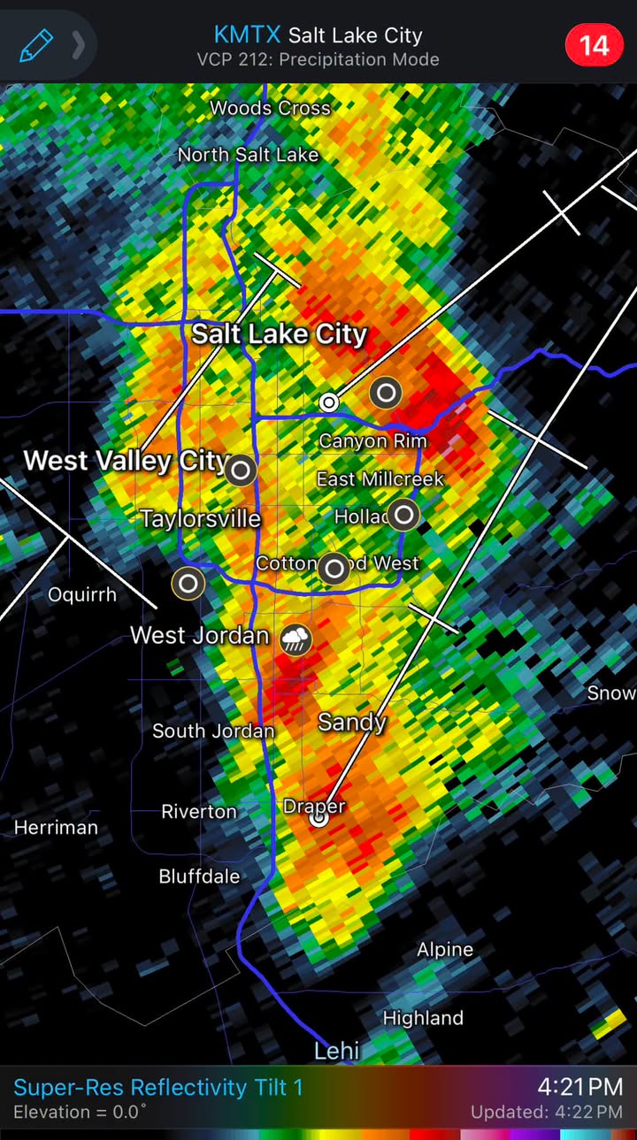
Flood advisories covered Millcreek and East Millcreek on Friday, Sept. 18, after a tornado and large hail hammered the northern Wasatch Front.
The National Weather Service confirmed the tornado touched down just before 2 p.m. near Fruit Heights in Davis County. A second flood advisory issued at 4:12 p.m. covered central Salt Lake County, explicitly naming Millcreek, East Millcreek, Cottonwood West and the Little Cottonwood Creek Valley, according to Gephardt Daily. Both advisories remained in effect until 7 p.m.
Between 0.5 and 0.75 inches of rain fell across portions of southern Davis County and northern Salt Lake County by 3:45 p.m. An additional half-inch to three-quarters of an inch was expected. Transportation cameras showed water ponding along parts of I-15.
Residents north of Salt Lake County took the worst of it. Eric Johanson, a pilot who was watching the storm from his porch, said hail damaged his mother's car mirrors and struck the skylight of his house, though it did not break. He ran outside to set up a camera and was caught in the downpour.
"By the time I got back to my camera, it was completely occluded. I was getting pelted by hail, I have welts all over my body," Johanson told ABC4.
He called it a "once-in-a-decade" storm.
In Layton, Fabia Kearl said she got stuck in her car when the storm hit and was frightened it would break her windows. Her basement partially flooded. Kearl said she had never experienced a tornado in 14 years of living in Utah.
The tornado touched down near Bair Canyon, east of Fruit Heights, at roughly 7,500 feet elevation, the Deseret News reported. Wind gusts of 50 to 65 mph swept areas north of Salt Lake County, with a peak gust of 78 mph recorded near Legacy Highway in West Bountiful. Hail near Kaysville in Davis County measured golf-ball and ping-pong size.
NWS lead meteorologist Monica Traphagen said the storm developed rapidly over the Great Salt Lake and showed significant rotation as it moved onshore in northern Davis County, according to ABC4's tornado coverage. The agency issued a tornado warning for parts of Weber, Davis and Morgan counties until 2:15 p.m.
Friday's warning was only the second tornado warning the NWS Salt Lake City office had issued in 2026. Utah averages about two tornadoes per year. KSL meteorologist Matt Johnson estimated the twister would register between EF-0 and EF-2 on the Enhanced Fujita Scale (EF Scale), though a final rating had not been determined as of Sept. 19.
The NWS urged motorists to avoid flooded roads, noting most flood deaths occur in vehicles. Morgan County Emergency Management advised residents to limit travel and stay inside for about an hour after the warning.
NWS meteorologists were expected to survey damage near Fruit Heights to assign a final EF Scale rating in the coming days.